Hiking
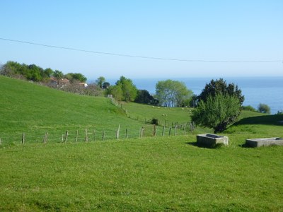
The steep mountains of Gipuzkoa provide an opportunity to hike among great natural beauty and Mutriku offers exactly this since it is a location where the sea and mountains meet.
Route GR-121 Talaia:
It is a part of the network of GR footpaths, extending from Fuenterrabía to Saturrarán, which passes through the points where lookouts were once used by sailors to spot whales. This is the origin of the name of this trail. This trail overlooking the sea, integrates areas of special interest such as the Special Areas of Conservation (SAC) Jaizkibel-Ulia, the Biotopo Iñurritza, el SAC Garate-Santa Bárbara and the Geo Park of the Basque Coast, as well as numerous beaches, coves, forts, villages and hamlets. In short, it offers an unparalleled opportunity to observe Gipuzkoa nature and culture.
In Mutriku, you can walk along two sections of this route:
GR-121 stage 07, Deba-Mutriku:
a 4Km walk that takes around one and half hours.
In the town of Deba is found at the mouth of the river bearing the same name, one of the most important in Gipuzkoa. The road to Mutriku starts after crossing the old stone bridge, along its last bend. Climbing to the top of the hill you will come across the lookout that was once used by villagers to observe the whales as they passed by. From here, you can see entire Gipuzkoan coast and on a clear day you can even seen the Bayonne coast.
During this trek, you will come across the Yeguada Olmedo Uranga, and the San Juan restaurant. Mutriku is the goal of this stage and once getting there you must visit the historic village centre to learn more about the history of its best known seafarers and their legends.

GR-121 stage 08, Mutriku-Saturraran:
4.45 km, duration one hour and forty-five minutes.
Download the itinerary
This stage is where the road crosses the Seven Beaches from the hilltops, with unrivalled views over the sea. On the way, you will come across the Santa Elena and Galdona campsites. This stage culminates at the beautiful Saturrarán beach and its unmistakable landform. Should you be interested in continuing, you can walk a little farther to arrive at Ondarroa, which is not too far away, by going along a path that unites the beach with the hamlet of Vizcaya.

Geo-route of Olatz (PR-47):
A journey of 6.5km that takes about two and a half hours. Download the itinerary
This path is of little difficulty, which crosses a very particular geological area known as “polje” (a type of valley formed by the erosion of calcareous stone), which is part of the Geopark of the Basque Coast. One of the more characteristic aspects of this area is its river, which disappears among the calcareous caves dispersed throughout the area. Also, along this route, which starts and finishes at the Hermitage of San Isidro, hikers have the opportunity to observe the geological and ethnographic aspects of the area, (limestones, caves, stelae and mythological monumental sites) while following the trailside information panels along the entire route.
Tour of Mutriku (PR-22):
A journey of 22km that takes about 6 hours and 30 minutes. Download the itinerary.
Circular route that starts and finishes in Mutriku. The route includes three summits: Arno (601m), Jangoikomendi (528m) and Tontorramendi (386m).
This route offers the opportunity to visit the chapels of Calvario and Santakutz, as well as to see funerary steles and enjoy the unique natural environment that Mutriku offers.
GR- 121 Route Bizkar:Mutriku-Eibar
This covers a distance of 21.5 km and takes about 8 and a half hours.
It is what is known as a great route (GT) going from Mutriku to Aránzazu, crossing the border between Vizcaya and Gipuzkoa and joining the Cantabrian Sea with the natural park of Aizkorri-Arazko. Along this route, the SAC of Arno and the industrial areas of Alto Deba must be crossed, which has a long industrial history where you can find the remnants of old salt mines, the steel industry and the blast furnaces.


